
Dr. Michael Ruhnke
|
Albert-Ludwigs-Universität Freiburg |
About me
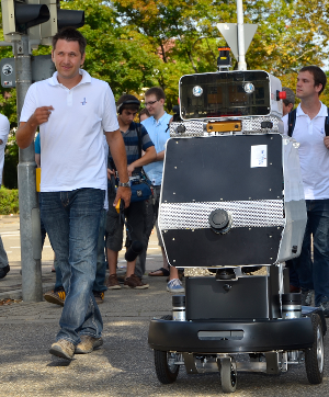
I am a former postdoctoral research assistant in the Autonomous Intelligent Systems group.My diploma thesis was about modeling objects based on 3D range scans. My research focused mostly on on object and environment modeling and lifelong navigation. During my time at the University of Freiburg I had the pleasure to work on the EUROPA project and be part of a team that developed a city scale autonomous navigation system for a pedestrian robot. I left the University of Freiburg in September 2016 and live and work in California now.
Research Interests
- 3D surface modeling
- 3D SLAM, Localization
- Lifelong Navigation
- Dense 3D model creation for Virtual Reality applications